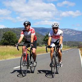
CYCLING
Whether it be Road, Gravel or Mountain Biking that tickles your riding fancy, the Upper Murray has it covered.


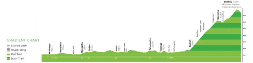
The Upper Murray is home to the highest sections of the High Country Rail Trail. The trail hugs the shoreline of Lake Hume from Wodonga to Old Tallangatta and then continues on the Cudgewa line to Corryong. The original railway line was built in 1887 and was used to transport material for the Snowy Mountain Scheme. The last train headed out along the track in 1978.
The scenic High Country Rail Trail takes in magnificent lake and mountain views, with railway and immigration history available along the way via interpretive signage. There are magnificent mountain views, historical sites and the cool waters of Lake Hume to enjoy along the 35 kilometres of trail between Wodonga and Old Tallangatta.
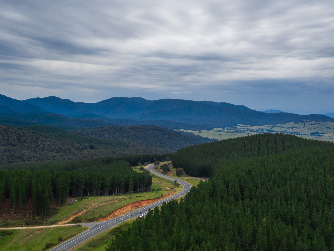
From Old Tallangatta to Corryong the trail is 74 kilometres and takes in pine plantations, State Forest and mountain views. The trail between Old Tallangatta and Corryong is being developed by Parklands Albury Wodonga in partnership with local community groups, including the Tallangatta Rail Trail Advisory Committee.
The following sections of trail are open for off-road riding in the Upper Murray and offer a unique rail trail experience suitable for all ages.
Darbyshire to Shelley - 20 kilometres
+ low quality + off-road gravel
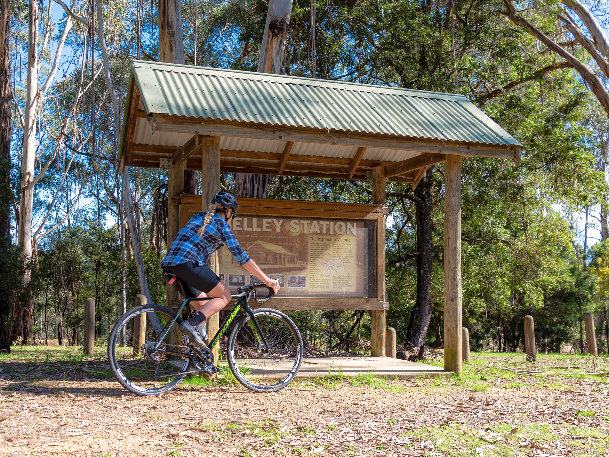
It is all downhill from Shelley Station, the highest railway station in Victoria, to Darbyshire (or all uphill if riding in the opposite direction). Ride through peppermint scented forests and over some spectacular restored timber trestle bridges. The 77 metres long Boggy Creek Trestle bridge is a great photo stop just after refreshments at the Koetong Pub.
Colac Colac to Corryong - 8 Kilometres
+ off-road, half seal, half gravel
Parking and picnic facilities are available at the start of the 8 kilometre trail between the Benambra-Corryong Road intersection and Corryong township. A half sealed, half gravel 3 metre wide trail weaves through farming land, following the route of the Murray Valley Highway but with wide seperation making for safe and peaceful riding. Passing by the Colac Colac Caravan Park, and termination at the Mt Mittamatite Caravan Park at the entry to Corryong, this is a perfect section of trail for visitors to the Upper Murray during their stay.
High Country Rail Trail Sections
| Section | Distance | Difficulty | Trail Notes | |
|---|---|---|---|---|
| 1 | Wodonga to Bandiana | 4.7kms | Easy | On-off road, full seal |
| 2 | Bandiana to Bonegilla | 7kms | Easy | Gravel trail, low quality |
| 3 | Bonegilla to Ludlows | 4.5kms | Easy | Gravel trail, low quality |
| 4 | Ludlows to Huon | 6.6kms | Easy | Gravel trail, high quality |
| 5 | Huon to Sandy Creek Bridge | 2.3kms | Easy | Gravel trail, high quality |
| 6 | Sandy Creek Bridge to Tallangatta | 9.5kms | Easy | Half seal trail, high quality |
| 7 | Tallangatta to Old Tallangatta | 9.5kms | Undulating | Half seal trail, high quality |
| 8 | Darbyshire to Shelley | 20kms | Challenging | Gravel trail, poor quality |
| 9 | Colac Colac to Corryong (see Town Map below) | 8kms | Easy | Half seal trail, high quality |

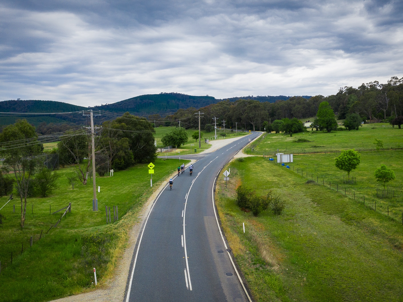
ROAD RIDES IN THE UPPER MURRAY
Colac Colac - Out & Back - 56 kilometres
This is a really pleasant ride through rolling countryside without any great challenges.
- Start at the Corryong Visitor Information Centre and head south-west along the Murray Valley Highway (B400) to Colac Colac (8km)
- Turn left into Corryong/Benambra Road (C545). Continue south as far as you’re comfortable. Stop for a well-earned break before turning around and heading home.
Nariel Gap -Out & Back - 32 Kilometres
- From the Corryong Visitor Information Centre head north-east towards Towong along the Murray Valley highway (B400) passing Mountain View Motel on your left.
- Turn right into Thowgla Road and follow it all the way down to the Nariel Gap Road.
- Enjoy the views and solitude before turning around and heading home
Tooma Road Ride - 68 Kilometres
Start at the Corryong Visitor Information Centre and head north-east out of Corryong along the Murray Valley Highway (B400). Follow for 6 kilometres and turn right at the T-intersection towards Khancoban.
- Continue over Towong Gap and cross the Murray River into New South Wales at Bringenbrong Bridge. Turn left at the next intersection into Tooma Road.
- Follow this road in its entirety (27km). At the Tintaldra Road T-intersection turn right to Tintaldra township.
- Turn left at the Murray River Road (C546) and ride south to Towong.
- Proceed around the sweeping bend at Towong and this road takes you back into Corryong.
Towong Loop - 50 Kilometres
- From the Corryong Visitor Information Centre head north-east out of Corryong along the Murray Valley Highway.
- Continue riding straight to Towong township, keep left on the sweeping bend and continue along the Murray River Road (C546) to Tintaldra.
- Turn left into the Cudgewa-Tintaldra Road and follow it south west for 16 kilometres and then turn left into Briggs Gap Road - which will take you back into Corryong.
Border Loop - 90 Kilometres
- Start at the Corryong Visitor Information Centre and head north-east out of Corryong along the Murray Valley Highway (B400). Follow for 6 kilometres and turn right at the T-intersection towards Khancoban.
- Continue over Towong Gap and cross the Murray River into New South Wales at Bringenbrong Bridge. Turn left at the next intersection into Tooma Road.
- Follow this road in its entirety (27km). At the Tintaldra Road T-intersection turn right to Tintaldra. Cross the Murray River at Tintaldra Bridge into Tintaldra township.
- With great care, cross the Murray River Road (C546) onto the Cudgewa-Tintaldra Road (C548) and continue to Cudgewa township.
- Stop at Cudgewa for a well-earned coffee and then ride on to the Murray Valley Highway where you turn left and ride back into Corryong.